Solutions
Know what's happening on every field, every day
Daily satellites plus a proprietary risk model on every field and zone — 1,200+ factors. Alerts, spray conditions, and compliance reminders on your phone — without driving out.
Free to get started — no credit card required
You can't be everywhere at once
Driving to every field to scout takes hours. Generic weather apps don't account for your soil conditions. And keeping track of compliance deadlines across dozens of fields is a full-time job on its own.
Your fields report to you
Xsupra checks every field daily with satellite imagery, local weather, and a proprietary risk model that screens every field and every zone against 1,200+ factors — diseases, compliance issues, vegetation anomalies, and more. You get prioritized alerts, spraying windows for your fields, soil moisture estimates, and reminders for compliance deadlines — all on your phone.
Proprietary risk model
A proprietary risk model screens every field and every zone within each field against 1,200+ risk factors — including diseases, compliance violations, vegetation differences, and more.
Your fields at a glance
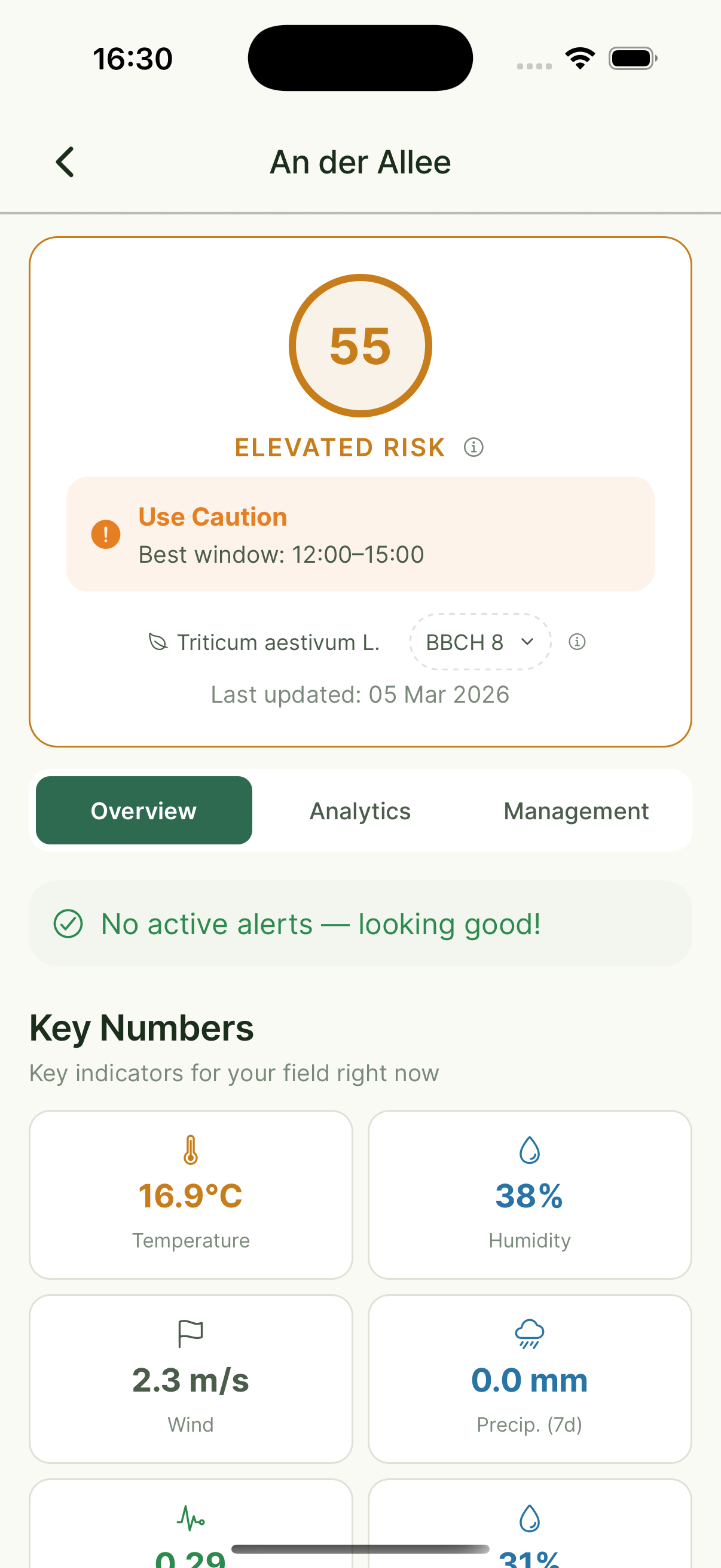
Field Overview
Risk scores & weather
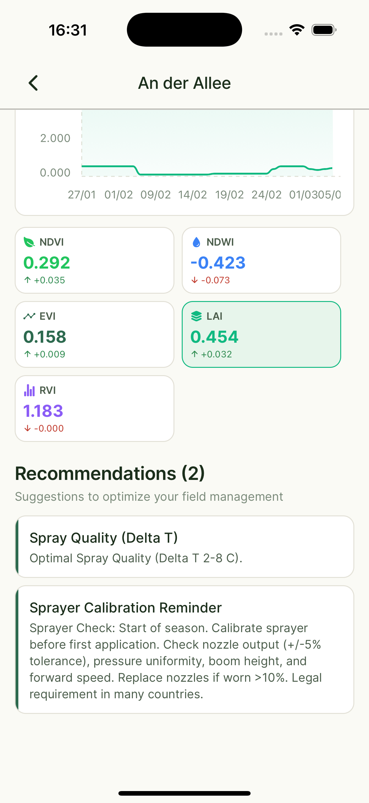
Analytics
Crop health data
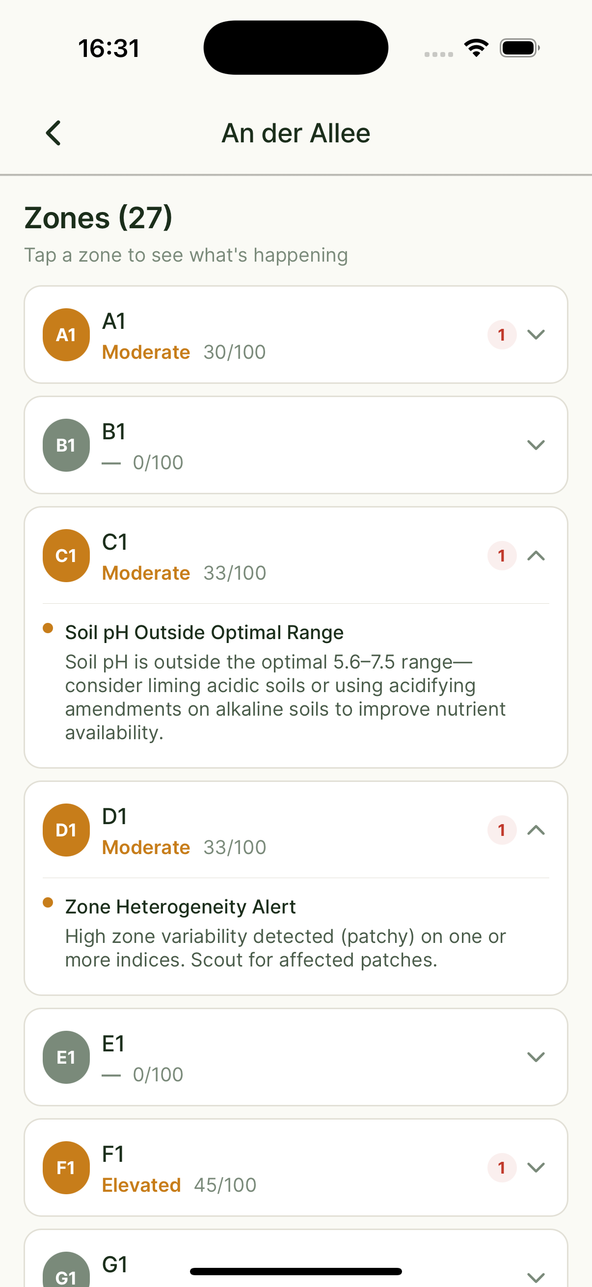
Zone Alerts
Per-zone alerts from the risk model
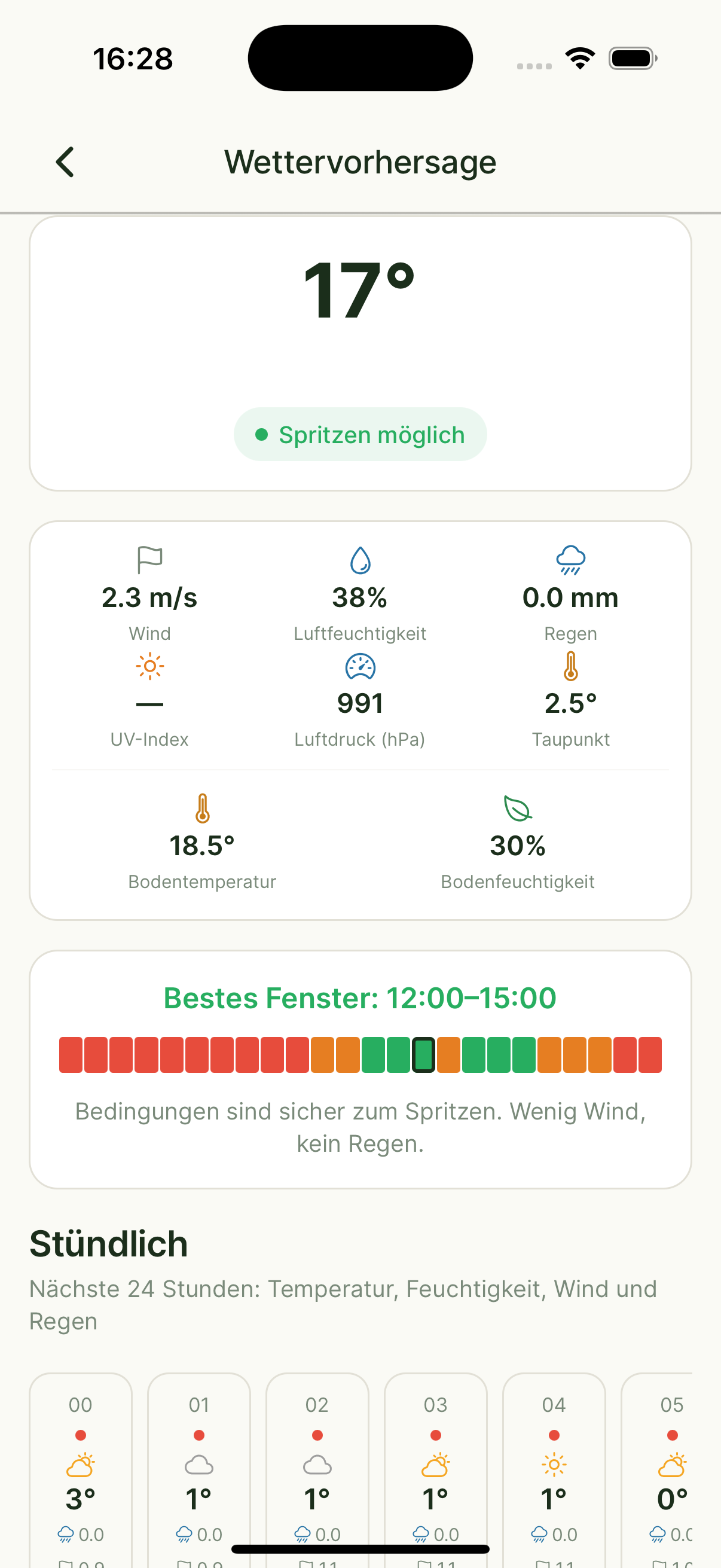
Spray Windows
Optimal timing
Your fields report to you
1,200+ risk factors per field and zone — prioritized alerts with clear recommended actions
Spraying conditions tailored to your specific fields and soil types
Soil moisture tracking and trafficability forecasts
Automated reminders for compliance and subsidy deadlines
Push notifications when something needs your attention
The data behind every decision
We combine satellite, weather, soil, and farm data into a daily intelligence picture for every one of your fields.
Satellite Indices
NDVI · EVI · SAVI · LAI · NDWI · Radar Vegetation Index — updated with every new satellite pass
Terrain & Topography
Elevation, aspect, and slope analysis to understand drainage, erosion, and microclimate differences across your fields
Soil Properties
All measured values (P, K, Mg, pH, organic matter) plus model-predicted soil moisture — from your own samples or our AI models
Hyperlocal Weather
Temperature, precipitation, wind speed & direction, humidity, and Growing Degree Days (GDD) — specific to your field location
Proprietary risk model
Our proprietary model evaluates every field and every zone daily across 1,200+ risks — disease, compliance, vegetation differences, and more. When risk rises, you get an alert with a recommended action.
Optimal Spray Windows
We analyze wind, temperature, humidity, and rain forecasts to suggest the best hours for spraying — so every application counts.
Zone-Level Alerts
Zone-level output from the same risk model — when a specific zone needs attention, you're notified immediately.
Farm Records & Logbook
All your logbook entries, crop rotation history, and application records — integrated so Alora and our models always have the full picture.
News, Research & Regulations
We continuously scan agricultural news, latest research findings, policy updates, and market data — so your decisions are always informed.
From monitoring data to shareable report.
All your monitoring data — vegetation indices, soil conditions, alerts, and activity logs — summarized in a professional PDF. Share it with anyone who needs to see what's happening on your fields.
What Farmers Say
“I see great advantages in Xsupra's monitoring to make the best decisions for my fields, even remotely!”
Andreas Bauch
Farmer
“AI assistants like Alora from Xsupra have the potential to be a powerful lever for farms. Alora doesn't make decisions — it accelerates research and data analysis and makes daily operations more efficient through targeted field inspections, with fewer routine tasks.”
Dorothee Scharpenberg, M.Sc.
Faculty of Agricultural Sciences, Uni Bonn
Ready to see how it works on your fields?
Book a free call. We'll look at your situation together — no sales pitch, just an honest conversation about whether Xsupra fits.
Free to get started — no credit card required