
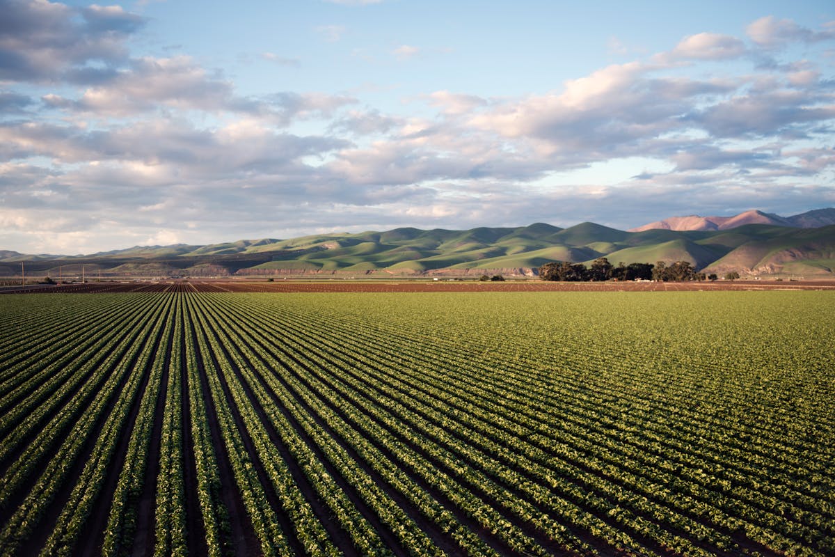
Stop guessing. Start farming with data.
Xsupra turns your field data into actionable application maps, daily monitoring, and intelligent recommendations — on your phone.
Free to get started — no credit card required
Here's how Xsupra helps
I'm spreading the same rate across the whole field — but I know it's not right everywhere.
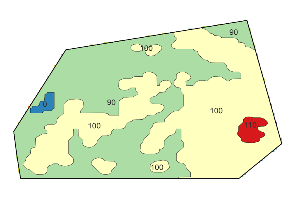
Model-based soil maps show you exactly where nutrient levels vary, so your application maps actually match what's in the ground.
Learn MoreEvery year I spend days piecing together what happened on which field.
Xsupra keeps a digital field record automatically. When it's time for your subsidy application, just ask — it's all there.
Learn MoreBy the time I noticed the problem, half the field was already affected.
Daily satellite checks catch vegetation anomalies early, so you can act before damage spreads.
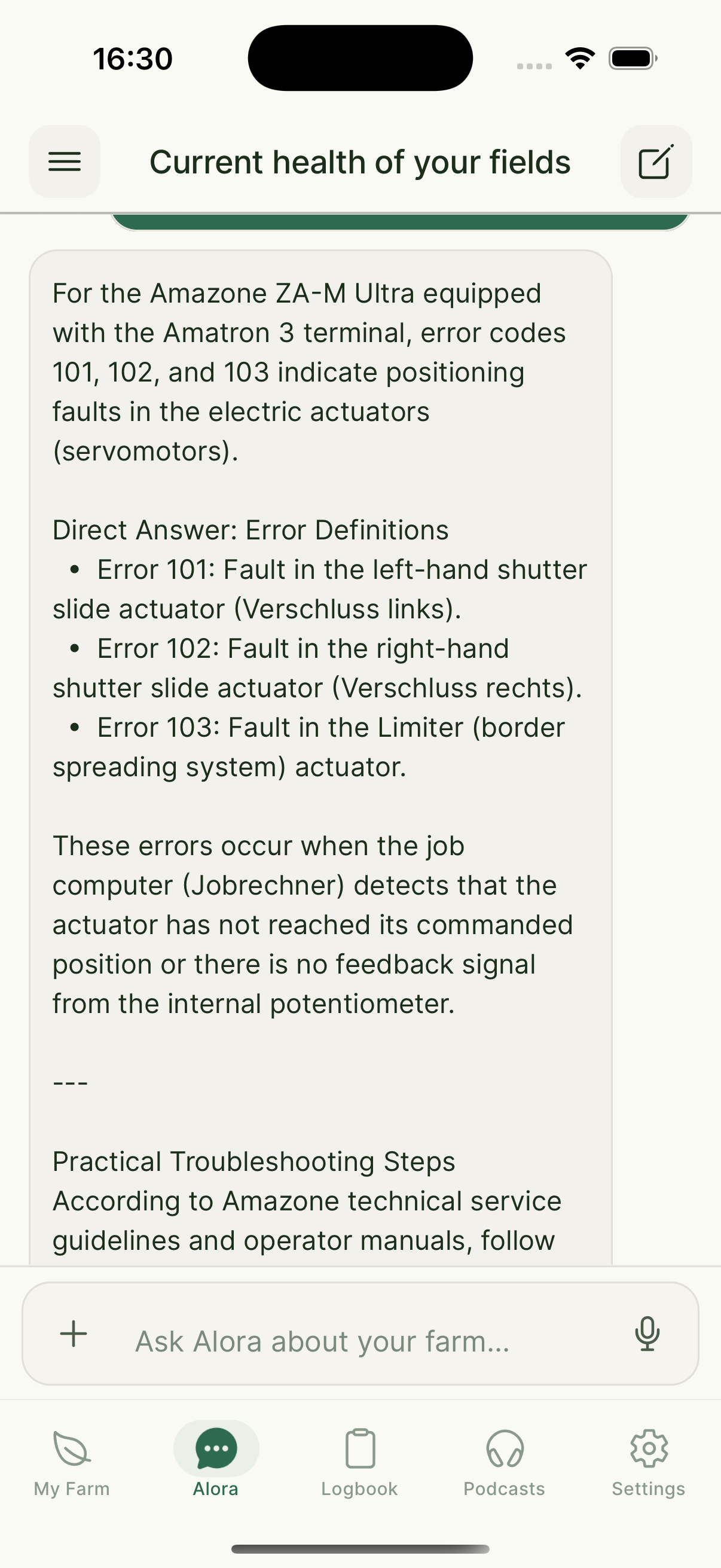
Learn MoreI need a quick answer, not an hour of googling.
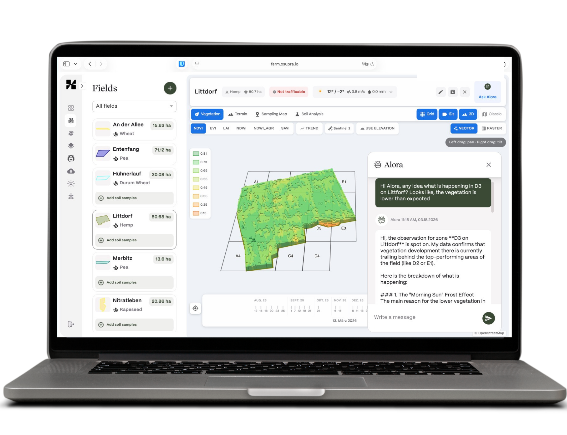
Ask Alora — by voice or text. She knows your fields and gives you a straight answer based on your data.
Learn MoreGrid sampling costs a fortune and the maps still don't match what I see in the field.
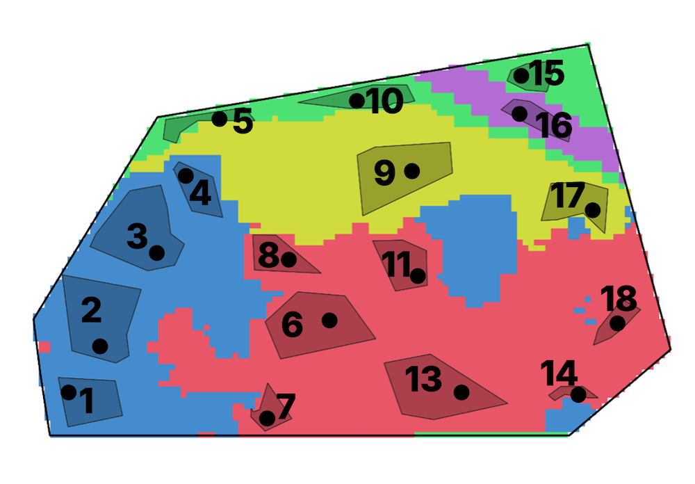
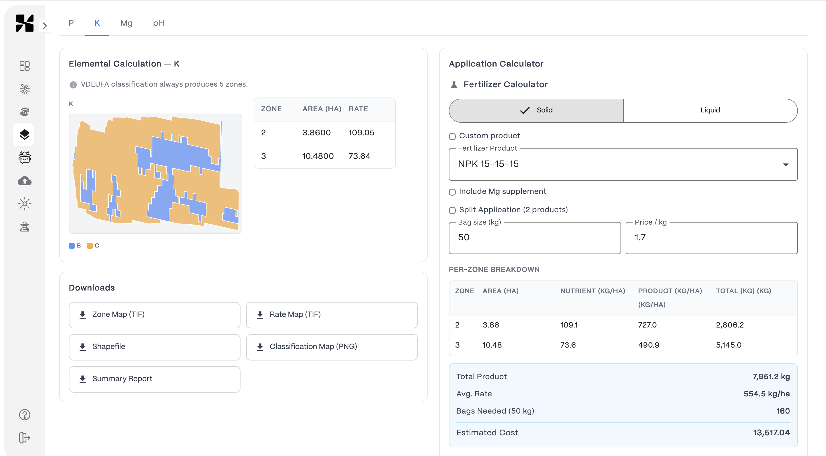
We identify real soil zones from satellite data. Fewer samples, and the resulting soil property maps capture actual field variation — not just grid averages.
Learn MoreFrom soil to decision in three steps
Sample
We identify zones in your field that actually differ. You take targeted samples — fewer than grid sampling, but far more informative.
Map
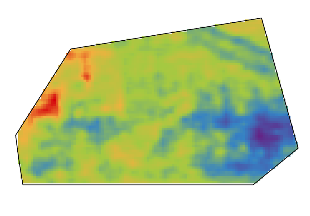
Our models turn your lab results into continuous soil property maps across the entire field — not just interpolated dots on a grid.
Act
Get application maps, daily risk alerts, and compliance tracking. Plus a morning audio briefing from Alora you can listen to on the drive.
See what you get
Soil maps, daily field monitoring, smart recommendations, and field records — all in one place, on your phone or computer.
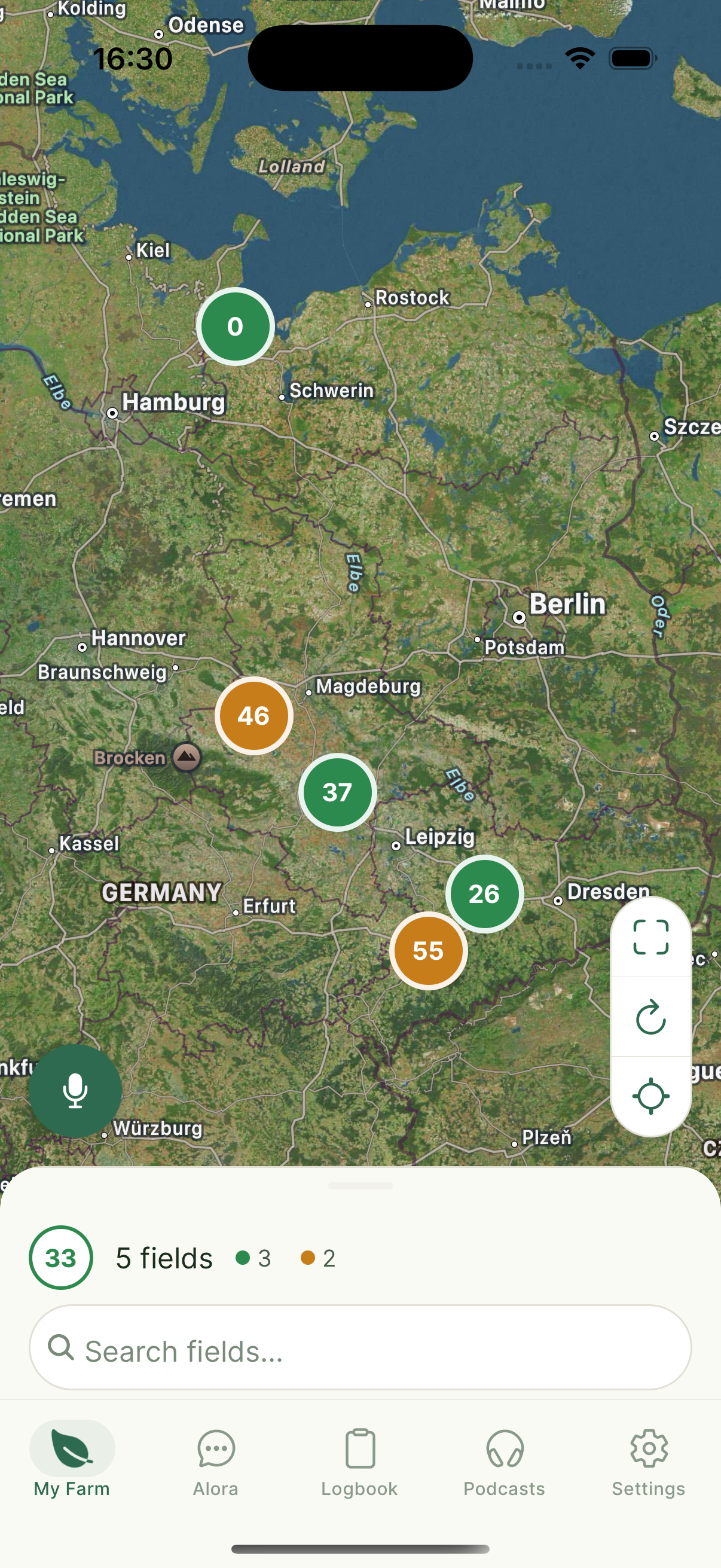
Farm Overview
All fields at a glance
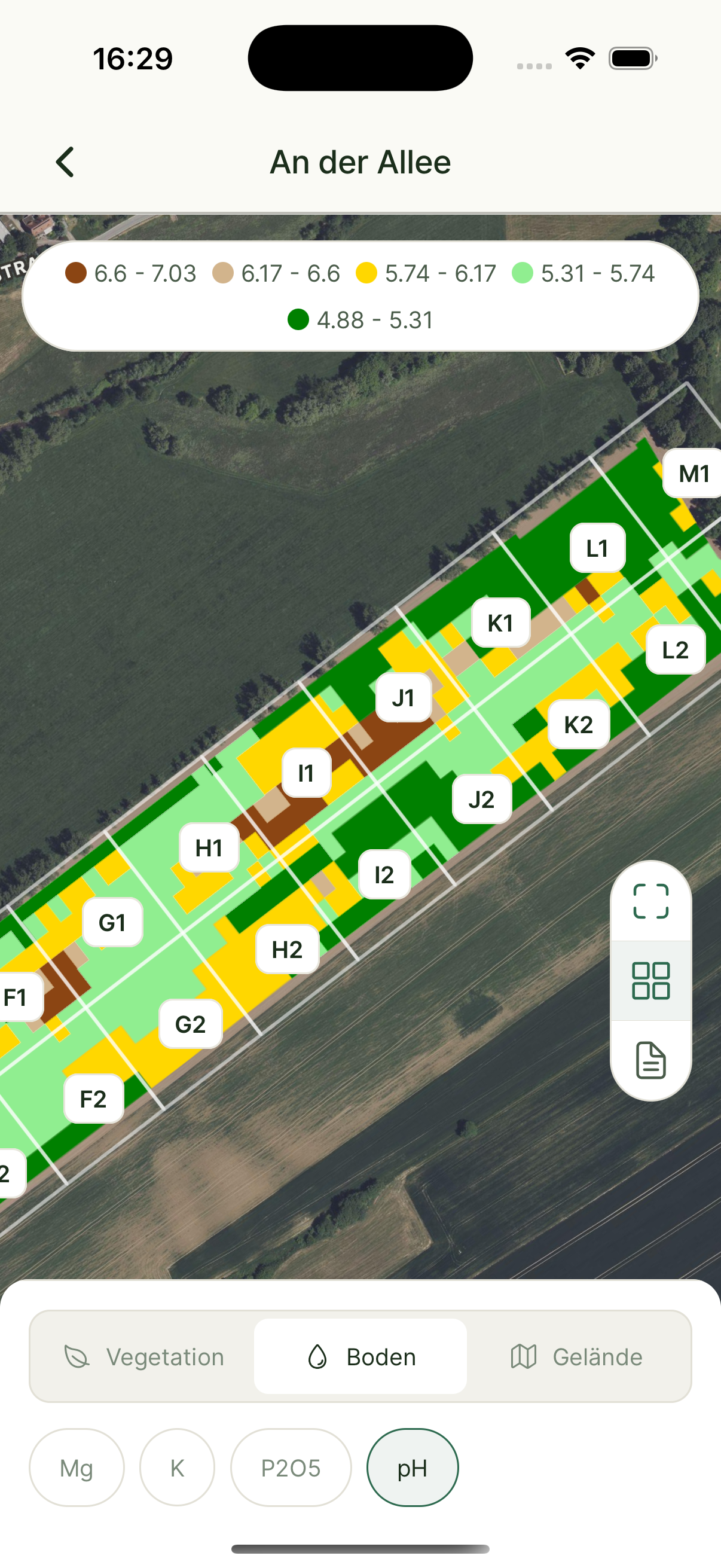
Precision Soil Maps
Modeled, not interpolated
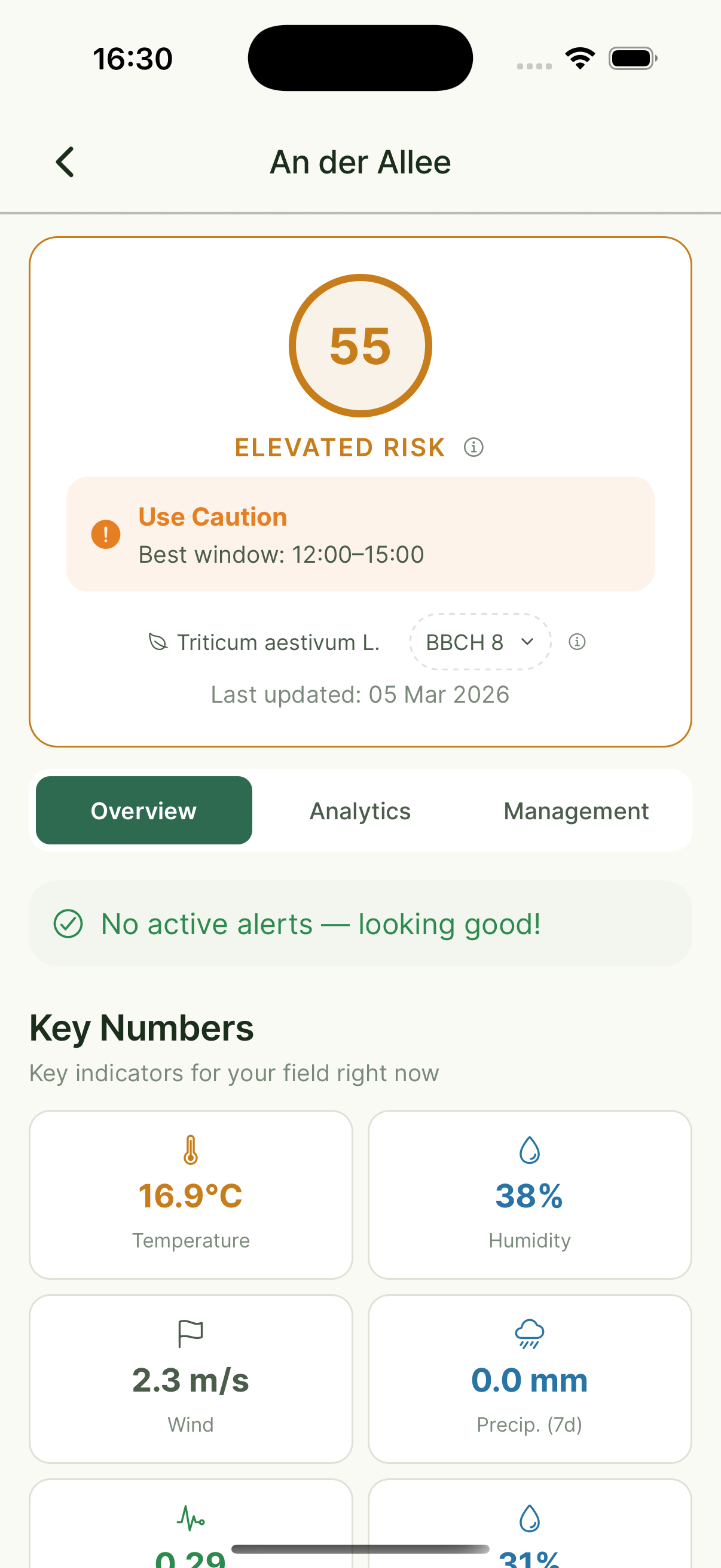
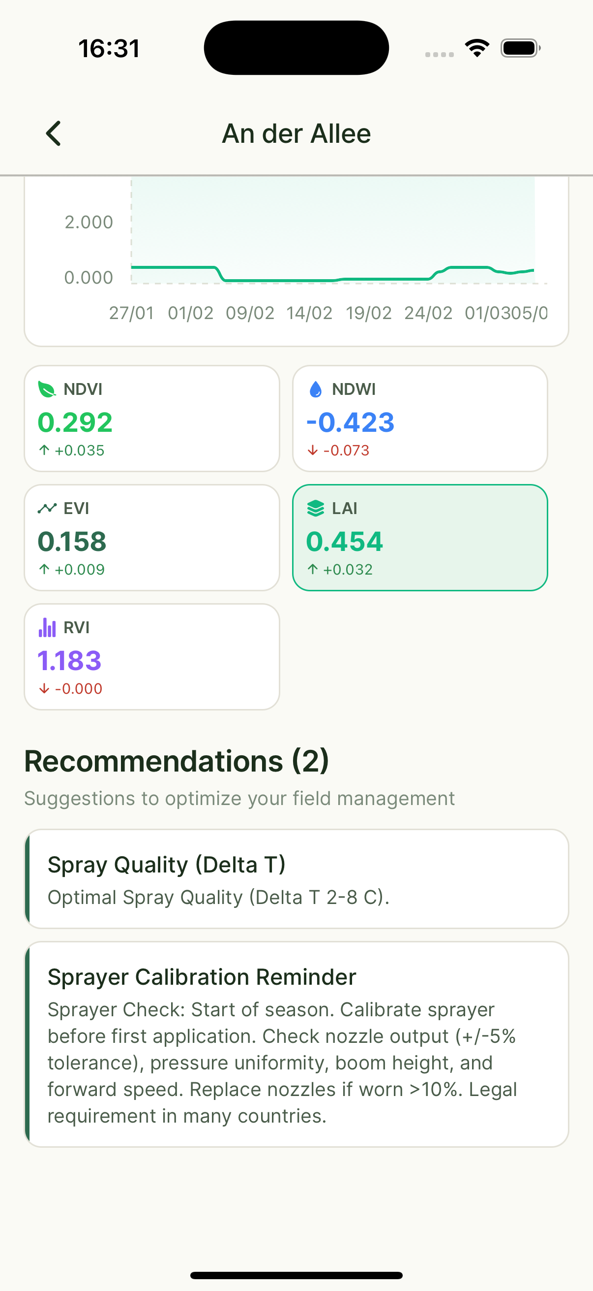
Field Detail
Risk scores & weather
AI Assistant
Ask Alora anything
Analytics
Crop health & tips
What we monitor for you — every single day
Real-time data from satellites, sensors, weather stations, and AI models — combined into one clear picture for your farm.
Satellite Indices
NDVI, EVI, SAVI, LAI, NDWI, Radar Vegetation Index
Terrain Analysis
Elevation, Aspect, Slope
Soil Intelligence
All farmer-measured soil properties (P, K, Mg, pH, organic matter, and more)
Weather & Climate
Temperature, precipitation, wind, humidity, soil moisture, GDD (Growing Degree Days), and more
Your Farm Records
Logbook entries, crop rotation history, application records
External Intelligence
Agricultural news, research, regulations, market data
Risk & Alerts
Daily risk index per field, zone-level alerts, optimal spray windows
What Farmers Say
“AI assistants like Alora from Xsupra have the potential to be a powerful lever for farms. Alora doesn't make decisions — it accelerates research and data analysis and makes daily operations more efficient through targeted field inspections, with fewer routine tasks.”
Dorothee Scharpenberg, M.Sc.
Faculty of Agricultural Sciences, Uni Bonn
“We compared Xsupra's sampling results with our in-house approach: the 10 x 10 m grid is significantly more accurate and precise. With the soil maps, we save up to 50% on fertilizer and about 6 hours per week on field inspections. The service and onboarding were very dedicated and professional — it's a pleasure to work with.”
Mathias Dippe
Agrar Dippe GmbH & Co. KG — 880 ha, 14 crops, Saxony-Anhalt
“What surprised me about Alora was its ability to think ahead! When discussing corn maturity, it automatically calculated the yield losses I'd face from a later sowing of the follow-up crop. I wouldn't have gotten that from any employee.”
M. Michta
Arable Farmer
5 min
Daily field check
14 days
Early warning lead time
Zero
Manual data entry
Built for the people who work the land
For Farmers
Spend less time driving to check fields and filing paperwork. Know what's happening and what to do next.
For Consultants
All your client fields in one platform. Pull up soil data, field history, and status in seconds.
For Farm Successors
Taking over? Ask Alora what was done on any field, when, and why. No more guessing.
For Cooperatives
One consistent data structure across all member farms. Unified monitoring and reporting.
One platform. Mobile and web.
Your fields, your data — accessible from your phone or your desk. No more juggling separate apps and spreadsheets.
Ready to see how it works on your fields?
Book a free call. We'll look at your situation together — no sales pitch, just an honest conversation about whether Xsupra fits.
Free to get started — no credit card required